Camp Joy
2012
Work on this map began in the summer of 2008. It was field checked summer 2010, and GPS mapped summer 2012. Map accurate to 3m. Camp Joy was the first of the four Lewis & Clark Council camps to be remapped. Two maps exist for Camp Joy. One created in ArcGIS, and one created in Open Office Draw. The Open Office Draw map was used as the official map from 2012 until 2017 when the Greater Saint Louis Council which anexed the Lewis & Clark Council in 2016 created their own maps using my source data.
Open Office Draw Map
MapSource Files
ArcGIS Map
MapShape Files
Google Earth KML Files
The Trails West Council combined with the Okaw Valley Council in 2009 to form the Lewis & Clark Council. This was a short lived and likely planned construction to prepare the councils for annexation into the Greater St. Louis Area Council in 2017. I updated my old maps with the new council name and sent them to someone in the new council. Somewhat comically, they never responded to my unprompted emails giving them the maps, but they did put the maps on their website, make new maps from the source, and remove attribution. But, to paraphrase Wilde, plagiarism is the best form of flattery.
Historic Maps
If you pick any Boy Scout Camp that has been around for a few decades, you will likely find many old hand drawn maps. Here are all of the maps that I have found on camp Joy. Some of these have been given to me, and some I found in various places on Council properties. Right click view image to see a full resolution version.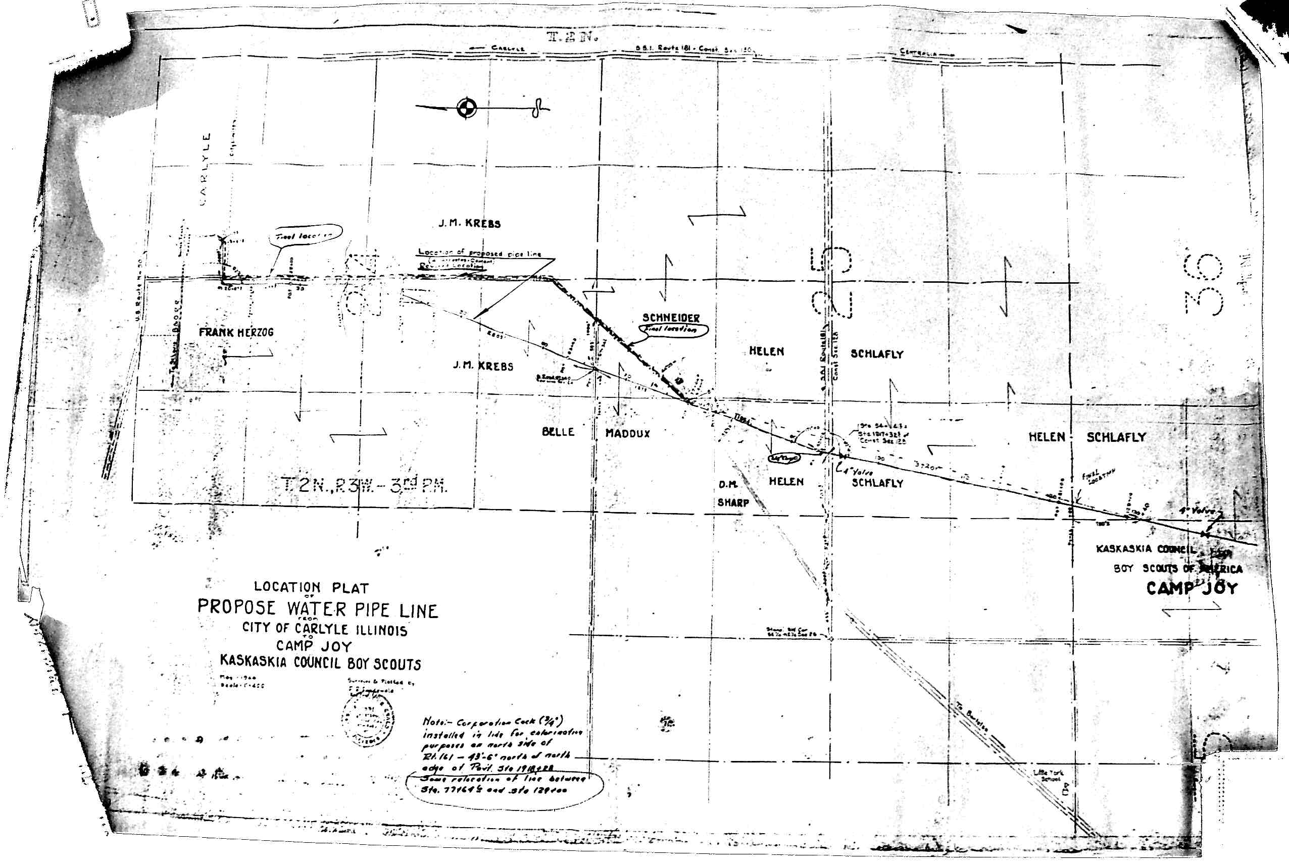
(ca ~1960) Plan for 4" Asbestous Cement Water Line From Carlyle, IL to Camp Joy. Map Found in Camp Office"

(ca ~1960) Map Found in Camp Warehouse Behind Aerial Photo
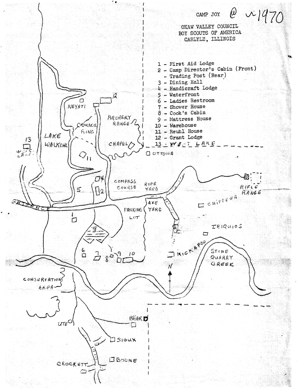
(ca ~1970) Map Given to Me by Scoutmaster
CJ1970.pdf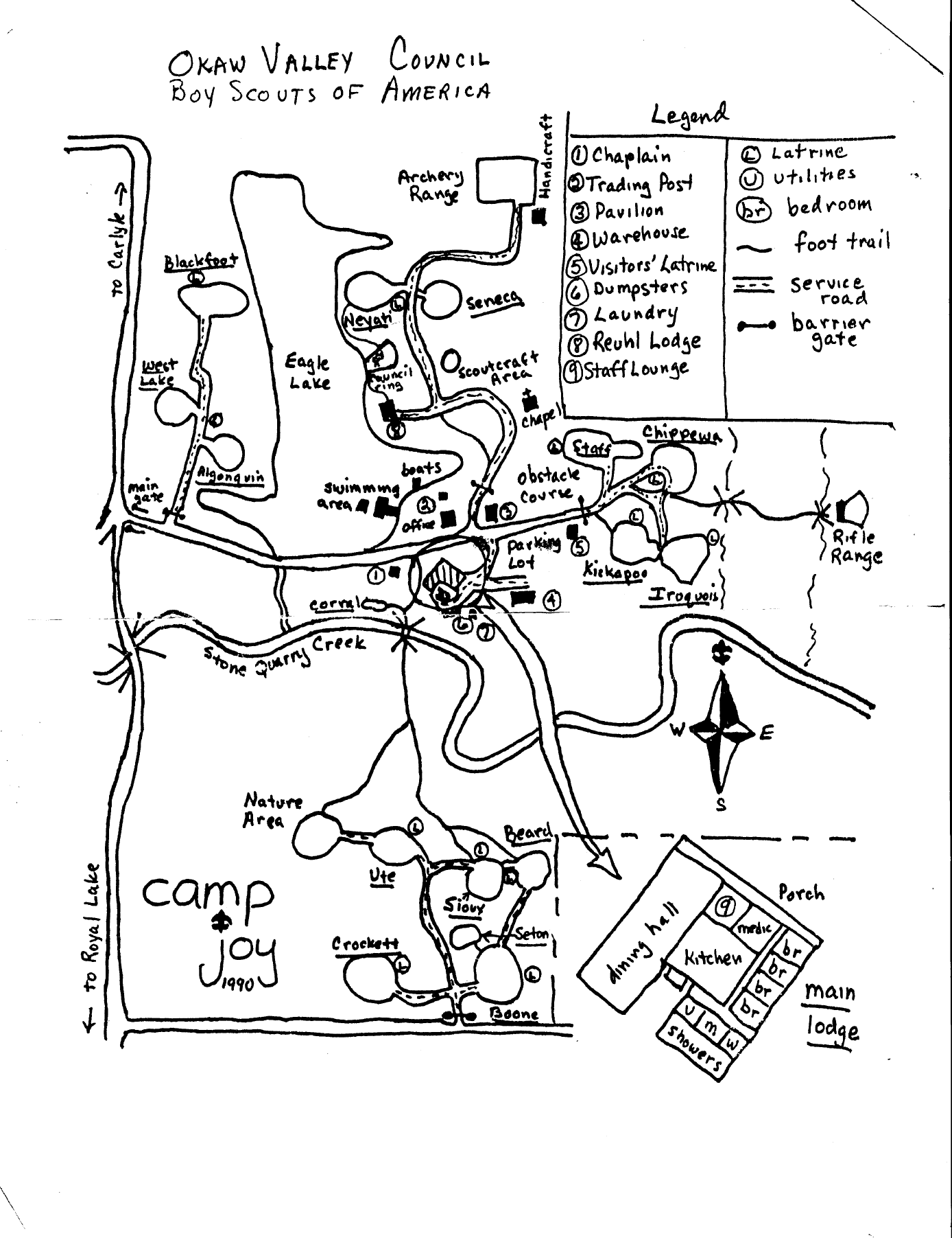
(ca ~1990) Map Found in Briefcase in Council Office Storage Area
CJ1990.pdf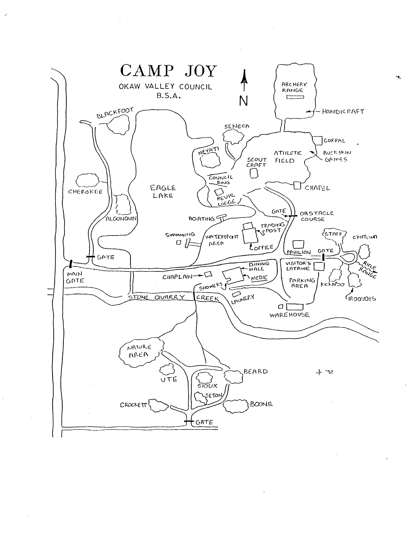
(ca ~1992) Map Found in Briefcase in Council Office Storage Area
CJ1992.pdf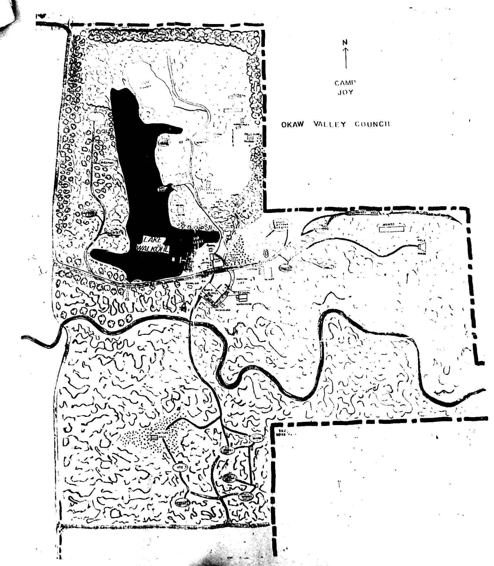
(ca ~2006) Map Found in Camp Office
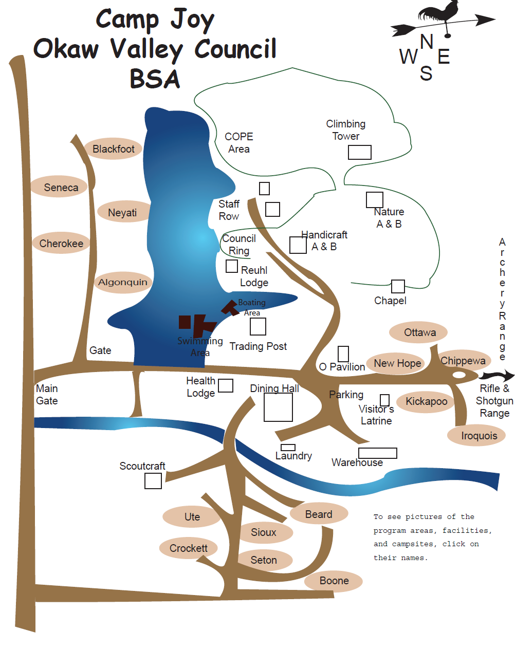
(ca ~2006) Map Found Online
CJ2006.pdf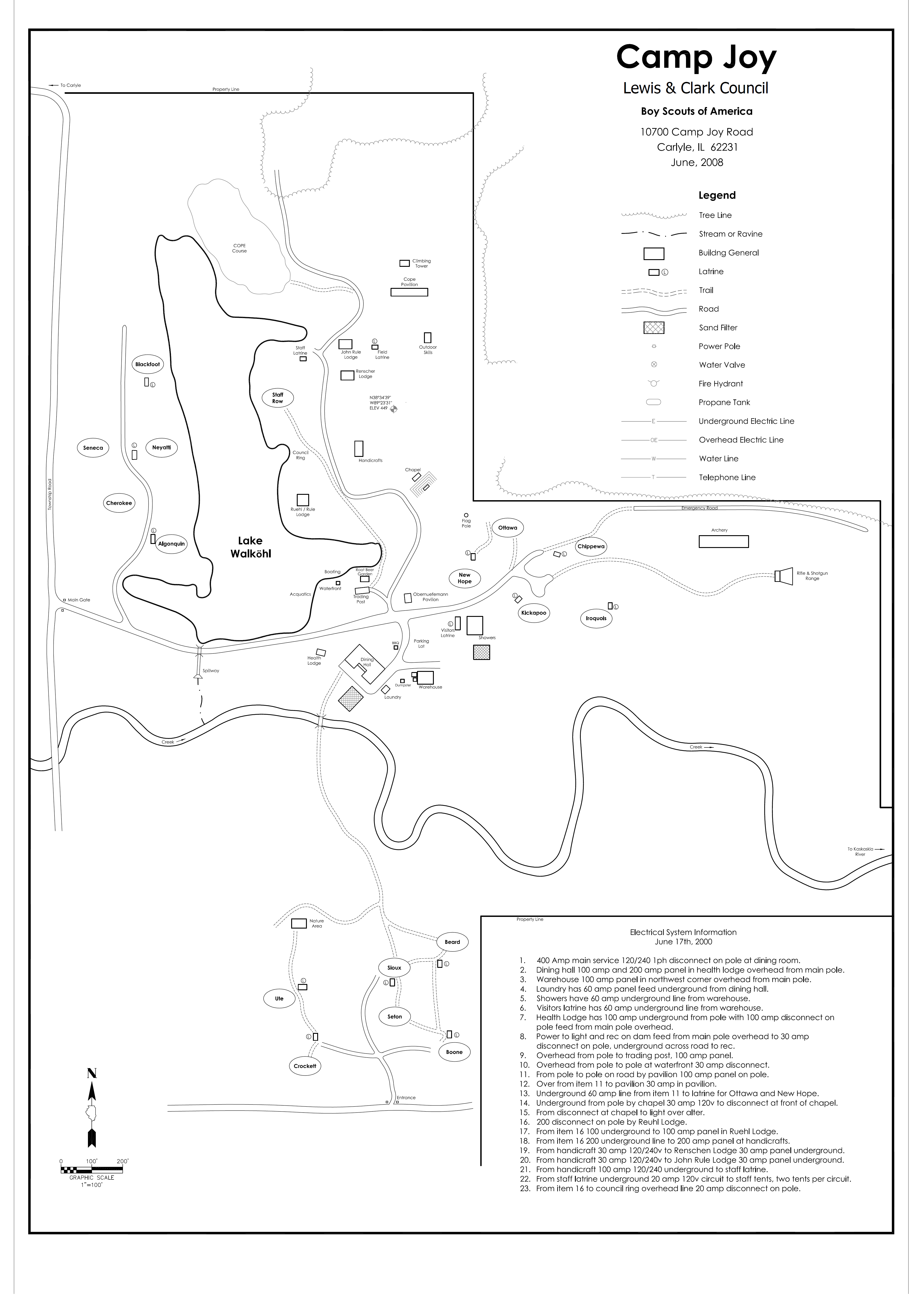
(ca ~2008) Map Found Online
CJ2008.pdf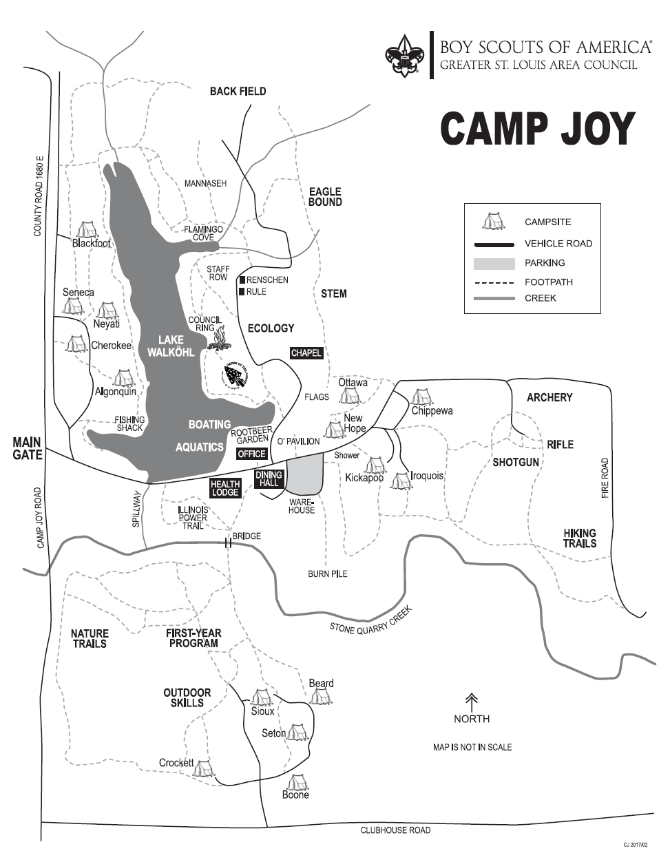
Current Council Map
CJ_GSLAC.pdf