Satellite Nadir Angle and Slant Range Calculator
2025
The angles and distances between a satellite and a ground station are easy enough to calculate with trig, but I made this calculator to save me the trouble of re-deriving the equations every time.
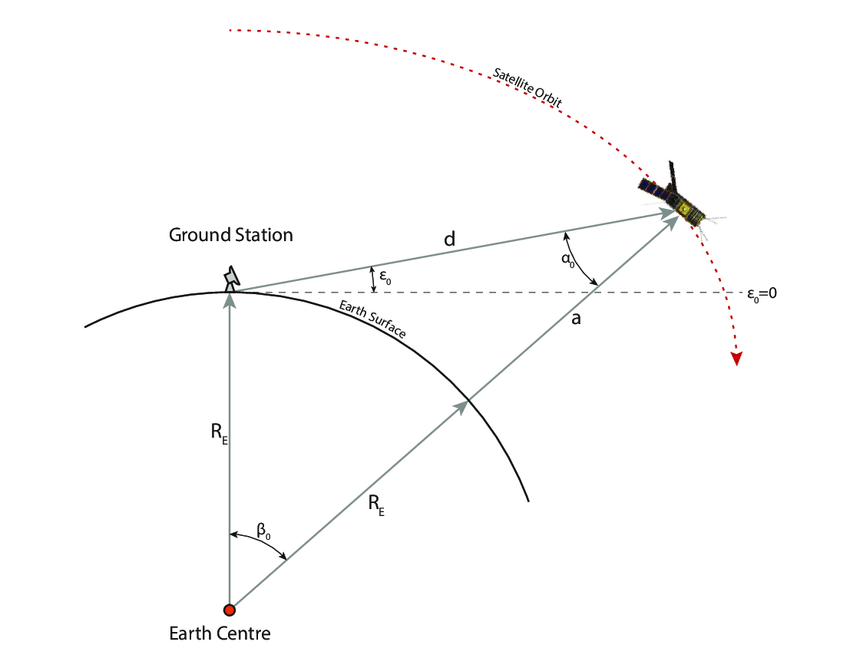
Diagram from here
I think the most intuitive way of solving this problem is to start with the law of sines:
\[\frac{sin(\alpha)}{R_e}=\frac{sin(\beta)}{d}=\frac{sin(90+\epsilon)}{R_E+a}\]If you are trying to calculate the satellite nadir angle α from elevation angle ε and altitude a, you can observe that:
\[\alpha = arcsin\Big(R_E\cdot \frac{sin(90+\epsilon)}{R_E+a}\Big)\]Once you have that, you can calculate β easily from:
\[\beta = 90 - \epsilon - \alpha\]And you can plug β back into the law of sines relationship to determine d:
\[d = R_e \cdot \frac{sin(\beta)}{sin(\alpha)}\]The portion of Earth's surface where the satellite is visible at this elevation angle and above can be determined by calculating the area of a spherical cap using the central angle β:
\[A = 2\pi R_E^2(1 - \cos(\beta))\]The distance along the earth's surface between the ground station and the point on the surface directly below the satellite is then given by:
\[d_s = R_e \cdot \beta \frac{\pi}{180}\]