Camp Sunnen
2012
This Map was field checked during the first week of summer camp at Camp Sunnen in 2011, and GPS data accurate to 5m was subsequently collected during the three weeks of summer camp held at the camp in 2012. There is an error in the acrege number on the open office map.
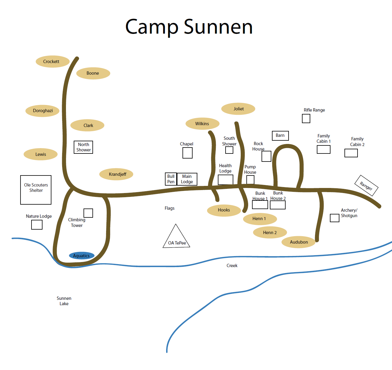
Open Office Draw Map
MapSource Files
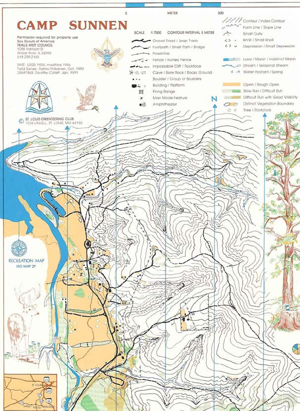
ArcGIS Map
MapShape Files
Google Earth KML Files
The Trails West Council combined with the Okaw Valley Council in 2009 to form the Lewis & Clark Council. This was a short lived and likely planned construction to prepare the councils for annexation into the Greater St. Louis Area Council in 2017. The council soon put camp Sunnen up for auction (and the auction company put my Arc GIS map on the auction listing), but the auction was cancelled at the last minute. At some point after that, the adjacent YMCA camp purchased the property. How it will be used in the future remains to be seen, but I am optimistic.
Historic Maps
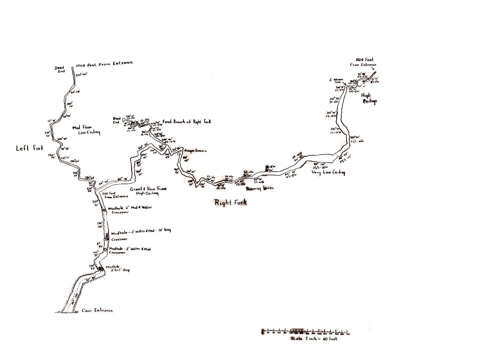
(ca unknown) Map of Mud Cave
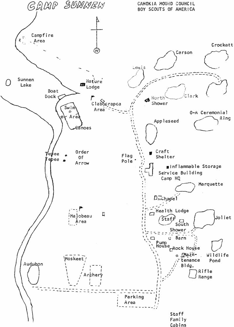
(ca ~1974) Map Found on Now Defunct Camp Staff Website
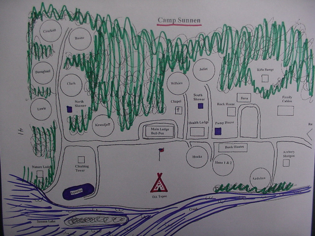
(ca ~1991) Map Found at Camp Staff Reunion
(ca ~1995) Map Found Online
(ca ~2000) Map Found Online
CS2000.pdf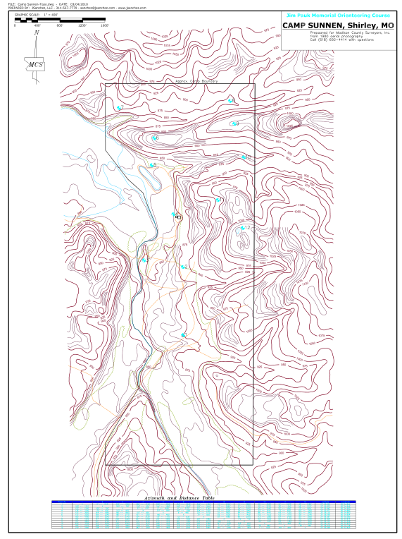
(ca 2010) Jim Pauk Memorial Orienteering Course Map
Orienteering Map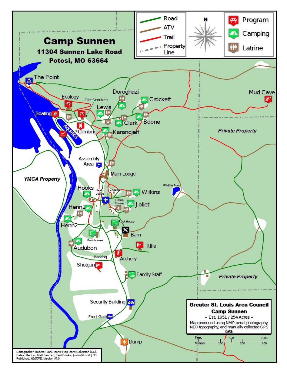
(ca ~2017) My Map
CS2017.pdf